Wednesday, August 7, 2013

Day 141, miles today - 17.0, total - 1,956.1

August 6, 2013

Campsite near South Arm Road to Sabbath Day Pond Lean-to.

We started hiking this morning a little after 8:00. To start our morning we went over Old Blue Mountain. It was a 2,200 ft. up, it was over three miles. But it was still a long up. It was clear and sunny today. We had several great views. Later we went over Bemis Mountain. There were a lot if blueberry bushes near the top. B-Rocket and I stopped to eat the blueberries for several minutes. We would have stayed longer, but we had a lot of miles still to do. We stopped on the trail to eat lunch. We usually try to stop at a shelter to eat lunch, but it was past time to eat and the next shelter was still a little ways. Much of the forest is thick with trees. In some sections they are growing a foot or so apart. 


When we came to the Bemis Mountain Shelter we stopped to check the log book and to get water. There was a group of young girls camping near the shelter. They were with a camp program from Canada. There were 10-12 girls age 14. They spoke French when talking to each other. We sat at the shelter talking to a section hiker. While we were talking some of the girls came over and sat near us. Most of them could speak English well. We asked a little about their camp. After refilling our water bottles we got ready to leave. One of the girls asked if we were thru-hikers. We told them a little about it. We would have liked to have stayed there. We enjoy talking about our thru-hike and listening to the girls speak French was interesting. But, we still needed to hike eight more miles, so we moved on.

We passed a few sobo's (south bounders) today. By the time we reached the Sabbath Day Pond, that's in front of the shelter, the sun was setting. Looking out across the water at the sunset was beautiful. We stood there enjoying it for several minutes. The water in the pond is very clear. Where we were standing was a very small beach. If it were ninety degrees out it would be a great place for a swim. I doubt that it got much above seventy today.


It was after 8:00 when we reached the shelter that is 200 yards from the Pond. There are a few nobo's here. There's Condor, Bulldog, Todd. There's one sobo. B-Rocket and I went down to the Pond to get water, and then we ate dinner. I had two tuna salad sandwiches, pretzels with Nutella, marshmallows with Nutella and a breakfast bar. At that point it was time to start getting ready to go to sleep. I am sleeping in the shelter. B Rocket set her tent up a short distance from the shelter. She was concerned about the insects bothering her.

Today was a long day. Ever since entering the Whites the miles have been much harder to come by. Before the Whites I could count on averaging 3 miles per hour without any trouble. Now there are sections that 1.5 mph is doing good. It's been an adjustment.


I got a text message from Gaurd, he goes by River Gaurd now. He said he finished, he made it to Katahdin. I knew he was at least two weeks ahead of me. I met him in the Smoky Mountains over three months ago. I hiked with him off and on for about one month. It was nice to hear from someone that I had hiked with that had finished. I'm happy for him.

Tuesday, August 6, 2013

Day 140, miles today - 10.1, total - 1,939.1

August 5, 2013

East B Hill Road to campsite near South Arm Road, Andover, ME.

B-Rocket's Aunt Annette drove us back to the trail. We left the camp at 8:00 am. It was 9:30 by the time we were on trail. The two days we spent at the camp were very enjoyable and relaxing.
Because of the shelter and campsite locations we needed to do either 10 or 18 miles today. With our late start we planned to do 10. We had a long gradual up to start the day. Overall pretty mild. We stopped at the Hall Mountain Lean-to for a lunch break. In Maine the shelters are referred to as a lean-to. From there we only had four more miles to reach the campsite we planned to stay at. We took a longer than normal lunch break. After lunch we went up and over Moody Mountain. It was a 1,400 ft. up in 0.8 of a mile. That's pretty steep. At the base of the up, B-Rocket and I were talking about the difficulty of the climb. I told her to think of it as two 0.4 sections. I told her that made it seem easier. She wasn't buying it. We met a thru-hiker named Mohawk. He started May 7. He's doing high miles. He was slack packing today. He passed us going up Moody. At the top was a nice overlook. It was clear and sunny today giving us a view of the surrounding mountains. We reached the campsite area at 5:30.


We were next to a road that was 8 miles from Andover. After setting up our tents we decided to give hitching a try. B Rockets cell phone needed to be charged, so we thought if we could get a ride she could charge it at the deli in town. The road was very small and not heavily traveled. After fifteen minutes we were ready to head back to our campsite. Just then a vehicle pulled up. Mohawk was in the passenger seat. Driving was the mother of one of his friends. She has been helping him with support through several states. She was dropping him off and then going to meet him at a road crossing further up trail. She got out and gave both of us each a bottle of Gatorade. She then offered us a ride into town. As she was dropping us off at the general store/deli, she asked how we were getting back to the trail. We said we would have to hitch hike. She offered to stay at the deli with us and then drive us the eight miles back to the trail. Her name is Shelley. She lives in Delaware. She sat in a booth with us as we got something to eat and charged our phones. It was very enjoyable talking to her about everything she's been doing to help Mohawk. We both told her about several of our experiences of trail magic and about life on the trail. She was very nice. While in the deli I met two girls that are thru-hiking. Their names were Cricket and Pancake. They started March third. I hadn't heard of them. They were staying in town.  Shelley dropped us off at the trail, I thanked her and told her that she had made our day, she said that we had made her day. Trail magic is great for those receiving and for those giving.


We met two more thru-hikers camping near us. One was Bulldog and the other Todd. Bulldog started March 19. The same day as me. So today we have met five nobo's (north bounders) for the first time.
It's a little after 9:00. I'm ready to get in my sleeping bag. It's just a little cool, it should be nice sleeping weather.

Sunday, August 4, 2013

Day 139, Zero day, total miles - 1,929.0

August 4, 2013

I woke up this morning at 7:30. After breakfast Jamey, B-Rocket and I went kayaking for about ninety minutes. It was warm and sunny. It was a lot of fun. It was a workout for my arms and shoulders. 


After kayaking I swam for a few minutes. B-Rocket and I laid on a floating platform with Cathy that has the "camp" next door. As a teenager she went to Mt. Katahdin with her father and sister. The night before she showed us a picture of them there. She said that in the late 40's her father met a man in the Whites and then later at Mt. Katahdin. The man told her father that he was the first person to hike all of the A.T. It's possible that the guy was Earl Schaefer. She had also stayed at some of the same huts in the White's that we did. She's 81 years old. It was enjoyable hearing about her and her fathers hiking trips. She is an impressive lady.


Jamey took B-Rocket and I into town to a grocery store so that we could resupply. She's going to drop us off at the trail tomorrow morning. For dinner, Jamey grilled hamburgers. Dianna and Annette made a salad and a few other items. It was a good dinner. 


Just a little about B-Rocket. She's 23 years old. She's a student at the University of Maine, she needs one more semester to get a degree in accounting. She has to be back for school by September 1. She had only been backpacking once before starting the A.T., and she didn't like it. Then a friend of hers, Katrina, asked her to hike the A.T. with her. B-Rocket agreed to give it a try. As it turned out, Katrina wasn't able to go. B-Rocket decided to give it a try on her own. She has hiked with several different people over the course of her hike, the same as me. She has lost over 45 pounds since starting the A.T.

Day 138, Zero day, total miles - 1,929.0

August 3, 2013

Today was a day of rest. I woke up at 7:30 am. 

I took a short nap twice during the day. I also went kayaking for about one hour with Jamey and Skyler. 


Looking out at the lake from the covered porch was very peaceful. They have a humming bird feeder hanging from the corner of the porch. Watching the humming birds come and go was pretty cool.


Jamey, Annette and Diana prepared food for everyone. I had plenty to eat.

B-Rocket suggested doing another zero here tomorrow. On one hand I wanted to get back on trail, but another zero would probably be good for my knees. They were both a little sore at the end of yesterday. So I was okay with taking a second day off.

Friday, August 2, 2013

Day 137, miles today - 14.9, total - 1,929.0

August 2, 2013

Speck Pond Shelter to East B Hill Road, Andover.

I woke up this morning at 6:00. There was a light steady rain. We started hiking at 7:30. The rain stopped around 9:00.

We stopped for a short snack break in the parking lot at Grafton Notch. While we were sitting there we saw a thru-hiker named Maggie.. Her mother was dropping her off. I had met her for the first time a few days earlier.

We stopped at the Baldpate Shelter to take a lunch break. Not-A-Bear showed up just as we were getting ready to leave.

After lunch we had a 1,000 ft. up over Baldpate Peak. We had great views from the top. We met a section hiker at the top. Before starting down we could see rain clouds moving in. There were blueberry bushes along side the trail. The three of us stopped for a few minutes to pick and eat the berries.


On the way down it started to rain. The rain drops were almost slush for a few minutes. The rain only lasted for 10-15 minutes.


We got to East B Hill Road at a little before 6:00. We sat at the edge of the road until B-Rocket's mother picked us up at 7:00. We tried, without any luck, to hitch a ride into town. We had hoped to get something to eat and wait for Jamey there in town. During the time that we sat there, only three vehicles came by.  


Jamey picked us up, we stopped at a Subway to get a sandwich, and then she drove us to the lake cabin that we had spent the night at last week. Everyone here refers to the cabin as "camp". We are going to zero here tomorrow. It will be nice to rest my knees, they have been a little sore the last few days. We have had a lot of steep ups and downs the past week.

Day 136, miles today - 9.5, total - 1,914.1

August 1, 2013

Carlo Col Shelter to Speck Pond Shelter.

We got a late start this morning. It was after 9:00 when we were on trail. 

We went over Goose Eye Mountain. We had a great view from the top.


We stopped at the Full Goose Shelter for a lunch break. There were three south bound thru hikers there. Not A Bear showed up a few minutes after us. Not A Bear hiked with B-Rocket and me for the next five miles.

We passed through Mahoosuc Notch. It's one miles long. The guide book says it is the most difficult or the most fun mile of the AT. It's a low area full of jumbled boulders. It's very challenging and slow going. You have to go over or under large boulders, some as large as a small car.  B-Rocket, Not-A-Bear and I went through together. Not A Bear and I both thought it was the most fun mile, B Rocket thought it was the most difficult mile. On the way through Not-A-Bear found a few M&M's on the ground. He said they were still in pretty good shape, so he ate them. When you've been on trail for over four months, your standards do change. 


After the Notch we went up the Mahoosuc Arm. It was a 1600 ft. up over 1.5 miles. Most of it was solid sheets of rock. It was as steep as walking up the roof of one of the new buildings at the school district I worked at. Doing that for 1.5 miles was a great workout.


When we got to the top we had an awesome view. There were a lot of clouds moving in and we felt a few rain drops. We decided to stay at the Speck Pond Shelter because it looked like the rain was definitely moving in. It was after 4.00 when we got there. We had planned to tent 4 miles up the trail.

Speck Pond

Day 135, miles today - 16.9, total - 1,904.6

July 31, 2013

White Mountain Hostel, Gorham, NH to Carlo Col Shelter.

I woke up this morning at 6:00. The  hostel made breakfast for everyone. It was very good. B-Rocket and I started hiking at 7:40. It looked like it was going to be a beautiful day.


We went through some low areas that had walk boards. Without them it would have been difficult to get through the muck and water in these areas.


We had a 1,750 ft. up to start our day. It was over 3.5 miles, so it wasn't too bad. We had some great views. We stopped for a lunch break at Dream Lake. From there we had a little more than 7 miles to reach the shelter. 


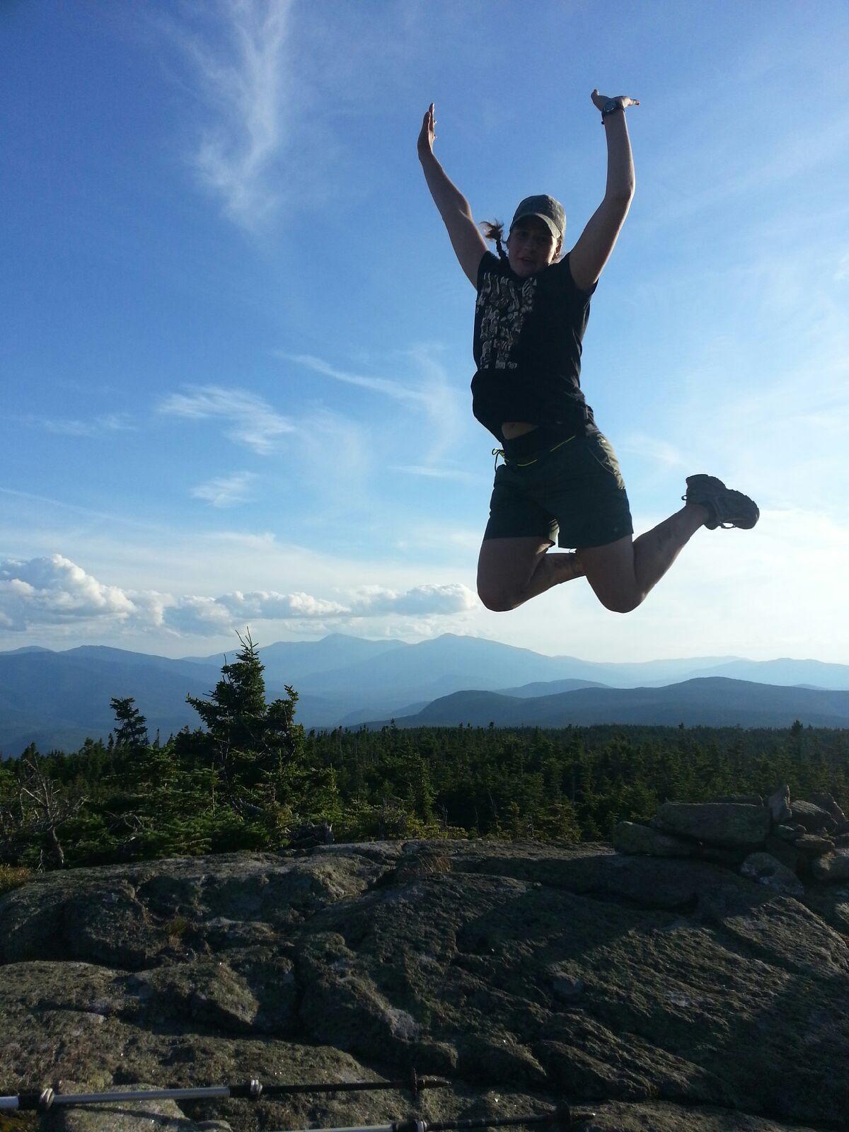
After lunch we climbed to the top of Mt. Success. From there we had a spectacular view. We were still able to see Mt. Washington. We stayed at the top of Mt. Success for a pretty good while. It was beautiful! From there we were about 7 miles from the Maine State line. We took pictures of each of us jumping into the air with the mountain view in the background.. We talked about staying there to watch the sunset, but with 7 miles to go quickly dismissed that idea. It was around 6:30 pm when we started hiking again.


As we were hiking we saw a grouse. It was walking on the trail, going away from us. It seemed odd that it didn't fly away. We then saw a baby grouse come out of the brush, cross the trail and then disappear into the brush on the other side. The mother continued to stand just a couple feet off the trail as we went by.


Our last 7 miles took a lot longer than we had thought it would. There were several really steep sections with large pieces of rock. It was very challenging to climb over. There was one place where B-Rocket took off her backpack and handed it down before climbing down. It was extremely difficult.

Two miles after Mt. Success we reached the Maine border. It was great seeing that sign. I now only have one state to go on this fourteen state journey. We only have about 280 miles to go. B-Rocket lives in Maine, so reaching it has even more meaning to her. She has been hiking home all along.


With it taking longer to hike the seven miles, we got to see the sunset after all. It was beautiful! We stopped to enjoy it for a few minutes. 


As we continued on it became darker. When we were under tree cover it was very dark. By the time we reached the Carlo Col Shelter side trail it was completely dark. We used our headlamps the rest of the way. We had a little trouble finding the shelter. There were a couple trails to choose from. We were walking through a very small stream, so we stopped to get water while we were there. After getting water I slipped on one of the wet chunks of rock. The rocks were the size of a small microwave. My right thigh hit awkwardly on other rocks. It was very sore the rest of the night. Hopefully it won't be an issue tomorrow.

When we reached the shelter at 9:15, we saw Not-A-Bear standing in front of it. There were a few other people asleep in the shelter.